Sometimes there’s nothing better than heading to New York City to experience a boost of energy and creativity.
I always welcome the opportunity to break out of suburbia.
When a family member from Italy stayed with my husband and me for several weeks, we made sure to explain how to use public transportation in New York City. Thankfully, my husband’s cousin is intelligent, young, and fluent in English, so our mini-lessons were very straightforward for him to understand. By the end of his stay, he had memorized major subway stops and the entire New Haven line route on Metro-North.
This guide was created to help anyone who needs help figuring out how to explore outside New York City, or anyone who’s looking to get their bearings in the Big Apple.
- An Overview of Public Transportation in New York City
- Metro-North
- Where does Metro-North go from New York City?
- Where to Find Metro-North Stations in New York City
- How to Buy MetroNorthTickets
- How much do Metro-North tickets cost, one-way?
- What is the difference between peak and off-peak tickets for Metro-North?
- Are there reduced or discounted Metro-North fares for families, students, military, and seniors?
- Can Metro-North stations be accessed at Penn Station?
- NYC Subway
- What is the difference between the subway and Metro-North?
- While we’re talking about the New York City subway, what happened to the MetroCard?
- How to Buy an OMNY Card
- Do I have to purchase the OMNY card to get access to the subway?
- Is there a map of the NYC subway that’s easy to read?
- I’m looking at the NYC subway map. Some trains stop at all of the stops, then some trains only stop at a handful of stops. What’s happening?
- I found the train line that I need to get on, but how do I know which track is the right one that I need to take?
- Ride-Share Apps
- PATH
- Amtrak
An Overview of Public Transportation in New York City
The subway and the bus are the primary modes of transportation to navigate New York City. Taxis and ride-sharing (i.e. Uber, Lyft, etc.) are also common, but less economical per ride compared to public transportation.
- New York City only – MTA subway, MTA bus
- Local/Commuter Rail– Metro-North Railroad, Long Island Railroad (LIRR), Port Authority Trans-Hudson (PATH)
- Regional – Amtrak
Is it safe to take public transportation in New York City?
Yes, it is safe to take public transportation in New York City.
It’s fair to be worried about personal safety in public spaces, especially in one of the most densely populated metropolitan cities in the world. We cannot ignore the tragedies that have happened in the past and their disconcerting frequency in the United States.
Residents and visitors alike should take safety precautions like anywhere else in the world—avoid walking alone late at night, being aware of your surroundings, share your location with people you trust, etc.—but New York City is generally safe.
As a tourist in New York City, it’s not uncommon to see some bizarre and eccentric activity—just because it’s different from what you may know, that doesn’t mean that it’s dangerous. You will know if it’s a genuine threat because everyone will be running in the same direction.
New Yorkers are unbothered and carry on unless there’s a real problem.
Metro-North
Where does Metro-North go from New York City?
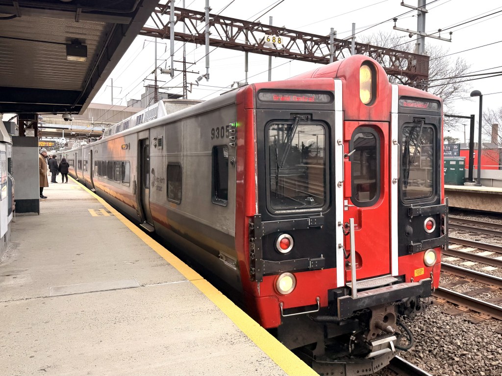
Metro-North is a commuter rail that services transportation between New York City and the suburbs in the states of New York and Connecticut.
From New York City to Connecticut suburbs and vice versa, riders can go as far as New Haven with the ability to access the New Canaan branch; the Danbury branch; and the Waterbury branch.
From New York City to New York suburbs and vice versa, riders can go as far as Wassaic and Poughkeepsie with the ability to access the Harlem Line branch; the Hudson Line; Pascak Valley Line; and the Port Jervis Line.
Where to Find Metro-North Stations in New York City
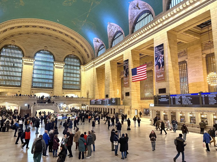
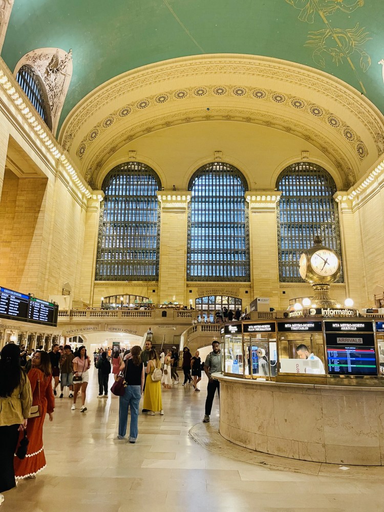
Grand Central Terminal is the terminus station for all Metro-North trains in New York City.
Grand Central Terminal also has transfers available to the Long Island Rail Road, buses, and several subway lines—visit Grand Central Terminal’s website for more information on all available transit options.
How to Buy MetroNorthTickets
There are two ways to buy tickets for Metro-North trains.
Tickets can be purchased in person at Grand Central Terminal at kiosks located on the main concourse level or purchased on the Metro-North TrainTime app.
Metro-North riders must have their physical or digital tickets ready to present to the conductor; otherwise, they may be subjected to a fine.
How much do Metro-North tickets cost, one-way?
It depends which zone you are traveling to and if it’s peak or off-peak.
For reference, from Stamford, CT to New York City it costs $17 one-way for peak fare; $12 one-way for off-peak fare.
However, from New Haven, CT to New York City—which has a further distance apart—it costs $26 one-way for peak fare; $19.25 one-way for off-peak fare.
What is the difference between peak and off-peak tickets for Metro-North?
“Peak” tickets are charged a higher rate because of—you guessed it—peak traffic during commuter hours.
Metro-North riders must purchase inbound “peak” tickets for trains that will arrive in New York City between 6-10 AM and for trains that depart New York City between 4-8 PM.
Please make sure that you purchase the correct type of ticket. Any riders who attempt to use off-peak tickets during peak hours will be expected to pay the difference. For riders who use peak tickets for off-peak hours, they will not be refunded the difference.
Are there reduced or discounted Metro-North fares for families, students, military, and seniors?
Yes. As of January 2026, up to 4 children ages 4-17 can ride Metro-North for $1 each when accompanied by an adult who pays the full fare. Children ages 4 or under ride free.
Visit the MetroNorth website to review the policy for special fares that apply to students, military, senior citizens.
Can Metro-North stations be accessed at Penn Station?
No, Penn Station does not have Metro-North stations—all Metro-North stations are located inside Grand Central Terminal.
Penn Station provides service to the Long Island Railroad (LIRR), Port Authority Trans-Hudson (PATH), and Amtrak.
Please do not confuse Grand Central Terminal and Penn Station—they are two different stations. This may seem like common sense, but I’ve had to clarify this to tourists who’ve asked me for directions over the years.
If you accidentally go to Penn Station instead of Grand Central Terminal, you can transfer by:
- Find the NYC Subway lines 1,2, or 3 heading uptown and get off at 42nd Street – Times Square
- Follow signs to the “S” Subway line, which is the shuttle between Times Square and Grand Central Terminal.
- After getting off the shuttle, follow the signs to Grand Central Terminal and “Main Concourse” for access to the main level.
NYC Subway
What is the difference between the subway and Metro-North?
While both Metro-North and the NYC subway are run by the Metropolitan Transportation Authority (MTA), they are two different types of rail transportation.
As previously mentioned, Metro-North is a commuter rail that services transportation between New York City and the suburbs in the states of New York and Connecticut.
The NYC subway lines provide service within four out of five boroughs in New York City—Manhattan, Brooklyn, Queens, and The Bronx. The fifth borough, Staten Island, can be accessed by taking the fare-free ferry or driving over the Verrazzano-Narrows Bridge that connects southern Brooklyn and Staten Island.
Tickets for Metro-North and the subway are not interchangeable. Subway tickets are purchased at a different kiosk.
While we’re talking about the New York City subway, what happened to the MetroCard?
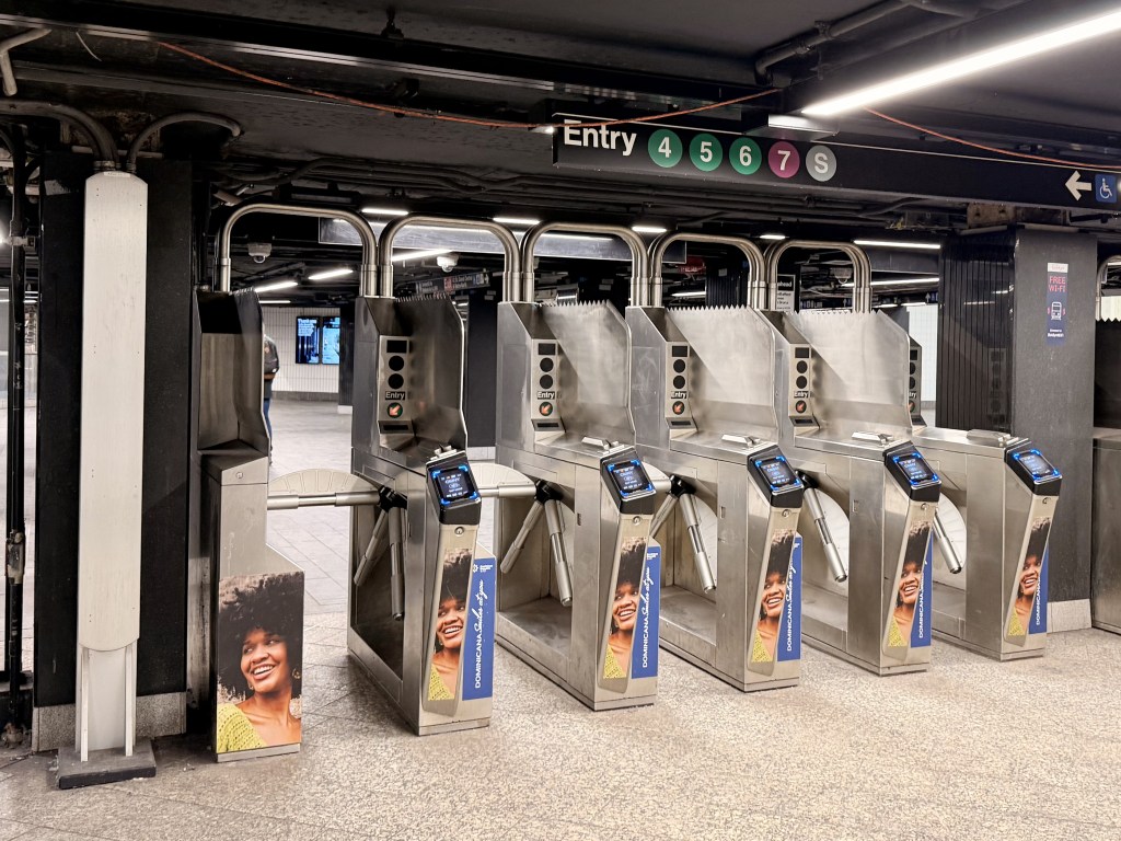
As of 2026, the MTA has phased out the MetroCard and replaced it with the OMNY card.
The OMNY card is accepted on the NYC subway, NYC buses, and other select regional travel.
How to Buy an OMNY Card
The easiest way to purchase an OMNY card is to head to a vending machine available at almost all subway stations—OMNY vending machines have been installed to replace MetroCard vending machines.
Alternatively, you can also purchase OMNY cards at select retailers throughout New York City, like CVS or Walgreens. Check out the OMNY retailer map on the OMNY website.
Do I have to purchase the OMNY card to get access to the subway?
Not necessarily, but it is highly encouraged for anyone who plans on using the subway regularly as a commuter or visitor. Digital “tap-and-pay” payments made with a contactless credit card or Apple Wallet are accepted.
If you want to access the subway with cash only, you must go to an OMNY card kiosk to process your transaction and purchase an OMNY card.
Is there a map of the NYC subway that’s easy to read?
Yes. MTA recently updated the map to easily view transfers and separate local and express lines.
I’m looking at the NYC subway map. Some trains stop at all of the stops, then some trains only stop at a handful of stops. What’s happening?
The trains that make less frequent stops are known as express trains—the purpose is to help riders get to where they need to go faster.
The trains that make more frequent stops are known as local trains.
For example, the 4 and 5 trains are express and the 6 train is local. From Grand Central Terminal, you can go downtown to the Brooklyn Bridge City Hall stop on any one of the three lines, but 4 and 5 will get you there faster.
However, if you want to reach the Bleecker Street station from Grand Central Station, you can either
- take the 4 or 5 to 14th Street – Union Square; then transfer to the 6, depart at Bleecker Street or
- board the 6 and stay on until departing at at Bleecker Street
I found the train line that I need to get on, but how do I know which track is the right one that I need to take?
It’s super simple. Are you heading “uptown” or “downtown” to access your destination?
You can figure that out based on the signage in the subway—it will say “uptown” or “downtown.” Worst-case scenario, you can also figure out which track is uptown or downtown by looking at the terminus destination and cross-referencing it with a quick Google Maps search.

Ride-Share Apps
I don’t want to take public transportation. Is it easy to use a ride-share app in New York City?
Yes, it is very easy to order rides from any major ride-sharing app.
What is the best app to use for ride-sharing in New York City?
While Uber is the most common, I suggest downloading Curb.
Curb is a ride-sharing app that works with NYC taxis and charges riders a flat fee upfront, so there are no surprises and no surge charges. Support the local yellow cab community and use Curb!

PATH
What is the PATH train?
Port Authority Trans-Hudson (PATH) connects New York City to New Jersey. The main NYC stations for the PATH train include Penn Station, 33rd Street, and the World Trade Center. The main NJ stations for the PATH Train include Newark and Hoboken.
As a tourist, unless you are looking to explore Jersey City or Hoboken, there is no reason to use the PATH train.
This blog post will not focus on the PATH train—this article in Untapped New York explains some fun facts about the NJ transit system.
Learn more about the PATH train on their website.
Amtrak
What is the difference between Amtrak and Metro-North?
Amtrak is for regional and, shockingly, national travel. Check out Amtrak routes from New York City on the Amtrak website.
I see that there are a handful of stops that overlap between Amtrak and Metro-North in New York City and beyond. Which train should I take?
If you are traveling from New York City to a stop that is both on Metro-North and Amtrak—Stamford—use Metro-North.
Why? Since Amtrak is used for regional travel, it makes more sense to book an Amtrak train from, let’s say, Newark, NJ (or further) to Stamford, CT instead of jumping from local trains and taking hours.

One thought on “How to Navigate Public Transportation in New York City”